
Hurricane Isaias makes landfall in North Carolina, bringing heavy rainfall, high winds and tornadoes to the east coast
A few minutes every morning is all you need.
Stay up to date on the world's Headlines and Human Stories. It's fun, it's factual, it's fluff-free.
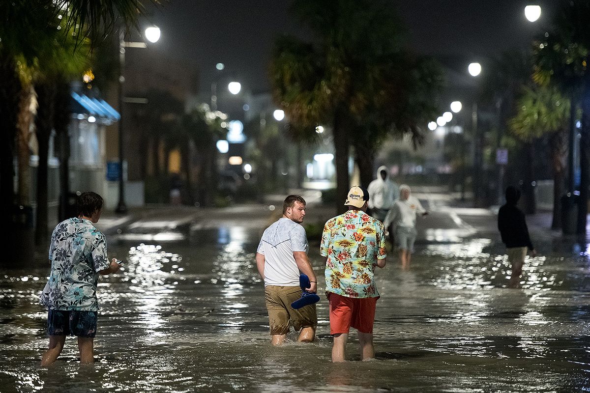
Tropical storm Isaias made landfall in North Carolina as a hurricane Monday night. It is set to move across the east coast on Tuesday, bringing heavy rainfall and high winds to New York, Pennsylvania and New Jersey.
The storm made landfall on Ocean Isle beach, North Carolina, with maximum sustained winds of 85 miles per hour.
By early Tuesday morning, Isaias had weakened to a tropical storm and moved up the Atlantic coast, impacting Virginia, Maryland and Washington, DC.
The storm continues to move north, toward New York, New Jersey and Pennsylvania. By early Wednesday morning, it is predicted to move toward the Northeast United States.
In North Carolina, the storm spawned multiple tornadoes and was responsible for fires and electrical disruptions for at least 360,000 residents.
One tornado hit a mobile home park in the town of Windsor, North Carolina, killing one person and injuring several others.
Officials are still assessing the extent of the damage caused in Windsor and in the state as a whole.
Officials in Bertie County, where Windsor is located, wrote on the county’s Facebook page, “We are asking that our community allow us time to gather and properly verify more information from the various law enforcement agencies and first responders still working to secure the area.”
On Tuesday, North Carolina Governor Roy Cooper said on Good Morning America that “We’ve had a number of tornadoes. I’m not sure of the count yet.”
However, Cooper said that the damage was not “as great as it could have been,” adding “all in all, this storm got in, got out pretty quickly.”
Tornadoes struck southeastern Virginia overnight on Monday, with the National Hurricane center adding early Tuesday that Tropical Storm Isaias would cause “potentially life-threatening urban flooding” in Washington, Baltimore and other cities along Interstate 95.
In Virginia, more than 300,000 utility customers suffered power outages. 5,000 customers lost power in southern Maryland and 200 customers saw outages in Washington.
Flash flood warnings were issued in several areas of Washington following extremely heavy rainfall. Areas near and along Interstate 95 were covered in one to three inches of rainfall, with the possibility of more on Tuesday.
Southern Maryland was also hit by six to seven inches of extreme rainfall, which led to flooding.
At 5 a.m. on Tuesday, New Jersey’s Democratic governor Phil Murphy issued a state of emergency, saying that a flash flood and tornado warning had been issued in the entire state. Murphy further warned all residents to stay indoors.
“All of us up here, and more behind the scenes, have been preparing for this storm,” Murphy said in a news conference announcing the flash flood and tornado warning.
“Hopefully — and this is our best case scenario — today will be just a washout and tomorrow we’ll be back to summer sun. But in the meantime, we hope for the best and prepare for the worst.”
New York Governor Andrew Cuomo also urged caution, asking “New Yorkers to be diligent and stay ready in case the storm intensifies on Tuesday.”
Democratic Mayor Bill de Blasio told New Yorkers in a news conference to “take this very seriously.”
“Between the rain, flooding potential, the winds, even the potential for a tornado — that’s a lot.” De Blasio added.
State agencies have deployed resources such as pumps and sandbags to tackle the storm in areas that are most at risk. New York City is under a tornado watch until 4 p.m. Tuesday.
The Delaware Emergency Management Agency also warned residents that tornadoes, flooding and heavy rainfall were a statewide threat and not merely limited to coastal areas.
On Tuesday, flash flood warnings were also issued in Allentown, Pennsylvania. The National Weather Service reported that northeastern Pennsylvania was most at risk.
“Significant risk of life-threatening flash and urban flooding continues in the Northeast from #Isaias. The HIGH RISK has been updated to include eastern PA, northwest NJ, and the Catskills region of NY. Recent report of 1 inch of rain in 15 minutes northwest of Philadelphia.”
In a special bulletin the National Weather Service wrote, “Flash flooding is highly likely, with some of it significant, and potentially life-threatening. Most impacted areas are the many metro areas of eastern PA, the Catskills and the southern Adirondacks later this afternoon.”
The storm is expected to ultimately move into the Northeast, with strong winds expected to hit Rhode Island and southeastern Massachusetts.
Have a tip or story? Get in touch with our reporters at tips@themilsource.com


Comments ()